Join our email list for the most up-to-date info!
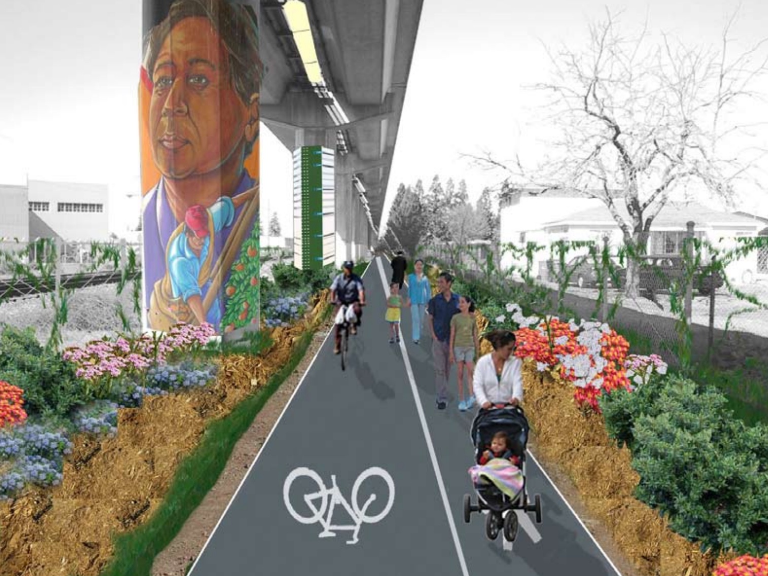
The East Bay Greenway is a planned, 30-mile facility connecting from Oakland to Fremont, linking between BART stations with a series of trails and protected bikeways.
Campaign Map
Click the dots to learn more about each project segment
ABOUT THE EAST BAY GREENWAY
Originally proposed in 2008 as a rail-to-trail conversion taking over the Union Pacific train tracks, the East Bay Greenway has since shifted to delivering mostly on-street bike facilities as the initial phase, adding physically protected bikeways and bike/walk trails along major corridors.
Despite an increase in the number of high quality bikeways around the East Bay, this Greenway will run through areas where the network is still sparse and good biking and walking routes are hard to come by.
By connecting between communities as well as to transit hubs this project will improve traffic safety on disinvested high-injury corridors while also providing access to opportunity as well as healthy and sustainable, multi-modal trips.
Major Projects
Click the city names below for project details
OAKLAND
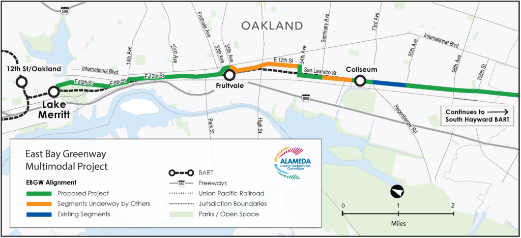
Lake Merritt to Fruitvale Protected Bikeway
Led by the Alameda Country Transportation Commission, this segment will add new protected bikeways and cycletracks following East 10th St, East 8th St, and East 12th St between Lake Merritt BART and Fruitvale BART.
Design is still underway but concept plans are available to review here.
Sign up for our campaign list below to be notified about public input opportunities coming later in 2025, ahead of a planned construction start in early 2026.
Fruitvale to 54th Ave Bikeway
This City of Oakland project will bridge the gap between Fruitvale BART and a separated pathway on San Leandro Street using a combination of protected bikeways and painted bike lanes between 35th and 44th Aves, and then a traffic-calmed segment with no bike lanes between 44th and 54th Aves.
This includes a “counter-flow” protected facility allowing 2-way bike traffic on the one-way part of E 12th from 44th Ave to 40th Ave.
Detailed construction plans are available here, with work expected to start in 2025.
Coliseum BART Trail Phase 2
Oakland is currently building a segment of the East Bay Greenway along San Leandro St north of Coliseum BART.
This project includes an off-street bike/walk trail from Seminary Ave to 69th Ave, then on-street bike lanes from 69th to 75th Aves connecting to an existing trail which continues to 85th Ave.
New pathway lighting, 70 new street trees, and pedestrian crossing and traffic signal upgrades are also included. Construction started in March 2024 and is expected to wrap up sometime in 2025.
SAN LEANDRO - ASHLAND - CHERRYLAND
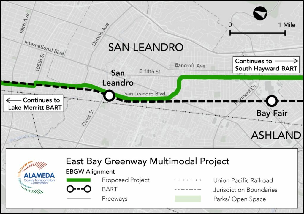
San Leandro Blvd & E 14th Bikeway
This project will continue from Oakland along San Leandro Blvd and E 14th St through San Leandro. The plan includes a combination of 2-way cycletrack, separated bike/walk pathway, directional protected bikeways, and a short paint-only bike lane segment.
Concept plans are available here.
Sign up for our campaign list below to be notified about opportunities to weigh in later in 2025, ahead of an estimated construction start in early 2026.
This will also connect with other protected bikeways San Leandro is working on along Williams St, Bancroft Ave, and Hesperian Blvd.
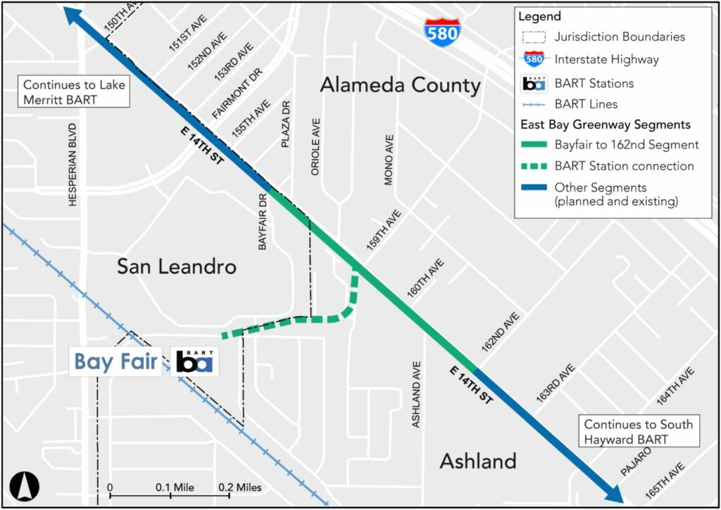
E 14th Bay Fair Bikeway
At the San Leandro and Ashland border, this project will continue the E 14th Ave protected bikeway further south, add several protected intersections, and a short bikeway spur connecting to Bayfair BART.
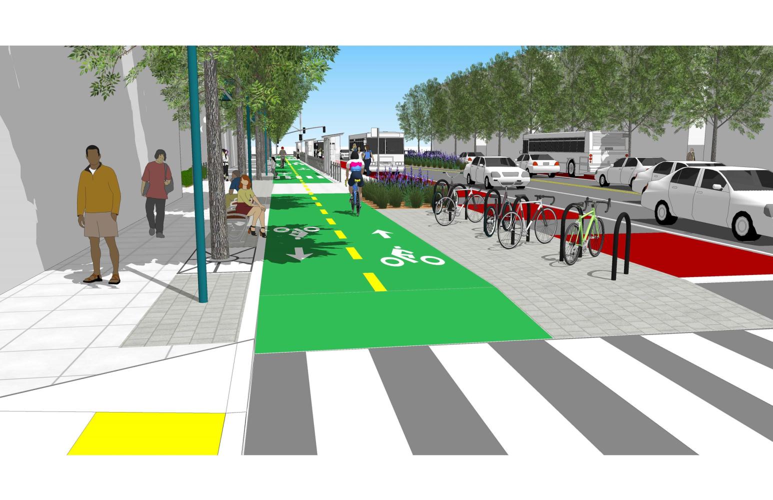
The project will connect to an existing facility on E 14th in Ashland which includes a protected bikeway in the northbound direction from 170th Ave to 164th Ave, and bus boarding islands with protected bike channels.
Concept plans are available here. A construction start date is not yet determined.
Mission Blvd Cherryland Bikeway
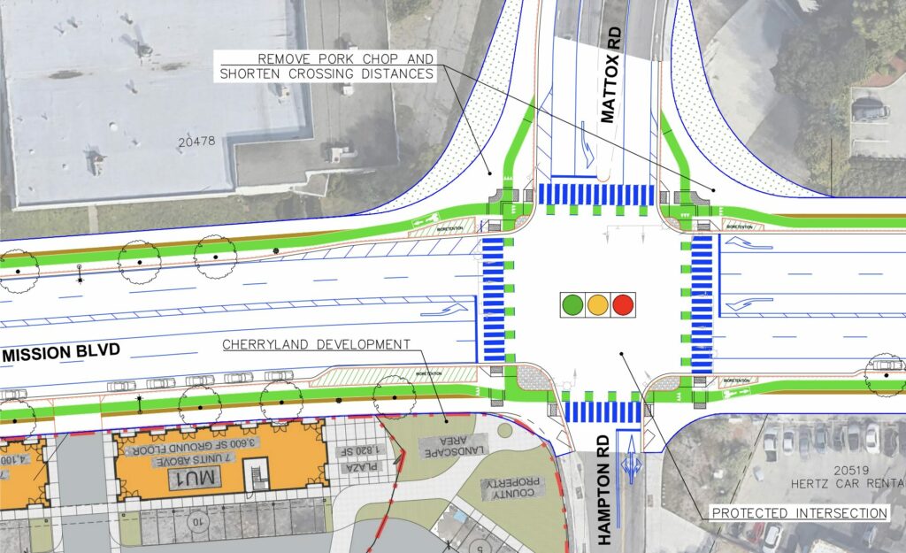
Running through the unincorporated jurisdiction of Cherryland, Alameda County Public Works will construct this mile of raised, protected bikeway along Mission Blvd between Rose St and the Hwy 238 underpass, including two protected intersections, landscaping, bus islands, and more.
No construction estimate is provided yet, project info is here.
HAYWARD
Downtown & South Hayward Bikeway
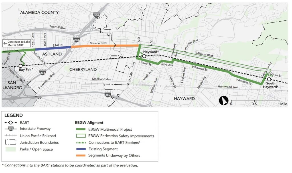
Originally proposed to continue straight down Mission Blvd, this project was controversially pushed to side streets including Grand, Silva, and Whitman St. The project leads at the Alameda County Transportation Commission are still promising a high quality bikeway but Bike East Bay and our partners at Bike Hayward are petitioning instead to maintain the Mission Blvd bikeway.
Read more from Bike Hayward and sign their petition to show your support. Project info is available here.
This segment will connect to a raised, protected bikeway just to the north from A St to Rose St under construction and estimated for completion in Spring 2025.
UNION CITY - FREMONT
Project info coming soon.
Join our Advocacy Mailing List
Stay updated on each campaign by indicating your interests below!
Campaign Updates
East Bay Greenway Updates: Oakland, Hayward, and Fremont
Read about planning, funding, and construction progress on our visionary East Bay Greenway campaign from Oakland to Fremont.
$235M in East Bay Biking, Walking, and Transit Projects Funded
Earlier this year the East Bay won over $300 Million for bike/walk projects from federal, state, and regional grant funding sources, and now another $235 Million has been awarded thanks
$300 Million in Project Funding for the East Bay
The East Bay won big with $300 Million in recent transportation award announcements from the federal Appropriations Bill, the federal Safe Streets for All program (SS4A), the federal Highway Safety
From Pop-Up to Permanent: Speak Up for San Leandro Protected Bikeways
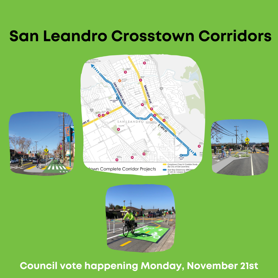
Update as of 11/22/2022: Thank you to everyone who turned out to comment in support of San Leandro’s protected cycletrack proposals on Bancroft Ave and Williams Street, following up on


