Search
Close this search box.
 
Loading Events

This event has passed.

Upper Telegraph Ave Protected Bikeway Open House, Oakland

January 17 @ 5:00 pm - 7:00 pm

Upper Telegraph Ave Protected Bikeway Open House, Oakland


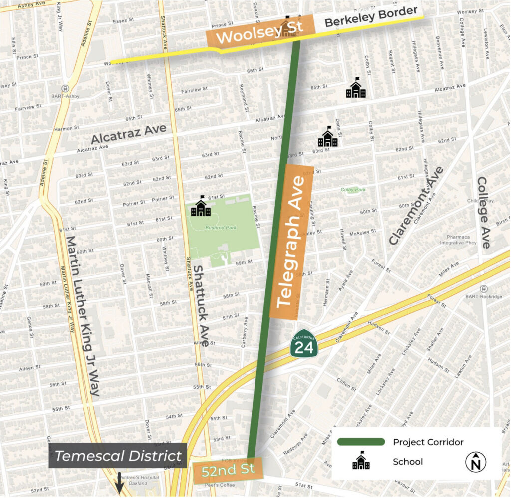
Map of Oakland Telegraph Ave project corridor, with a line drawn on the street from 52nd St to Woolsey St on the Berkeley border

Stop by the January 7 farmer’s market or join the January 17 open house to learn about Oakland’s plan for enhancing connectivity and safety on Telegraph Avenue, 52nd Street to Woolsey Street, as part of an upcoming paving project in 2026.

UPCOMING EVENTS & MEETINGS

Sunday, January 7, 2024: Temescal Farmer’s Market, 9am to 1pm @ 5300 Claremont Ave, Oakland

Wednesday, January 17, 2024: Open House from 5pm to 7pm @ Temescal Branch Library, 5205 Telegraph Ave, Oakland

Sign up for project updates here

CONCEPT IMAGES:

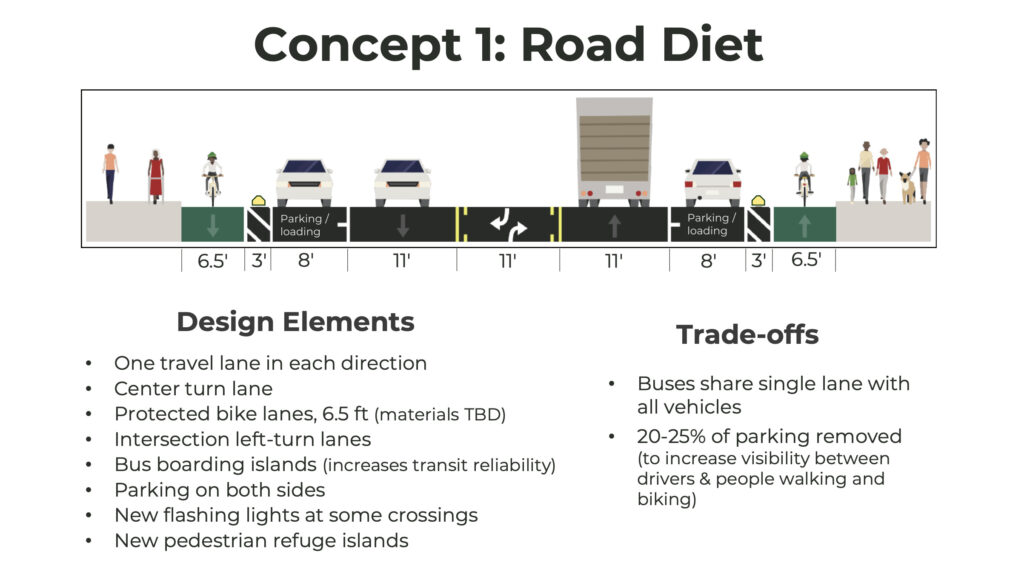
Roadway cross section illustration showing curbside projected bike lanes to the right of parked cars, but no bus-only lane. Text: "Concept 1: Road Diet Design Elements • One travel lane in each direction • Center turn lane • Protected bike lanes, 6.5 ft (materials TBD) • Intersection left-turn lanes • Bus boarding islands (increases transit reliability) • Parking on both sides • New flashing lights at some crossings • New pedestrian refuge islands Trade-offs ・ Buses share single lane with all vehicles ・ 20-25% of parking removed (to increase visibility between drivers & people walking and biking)"
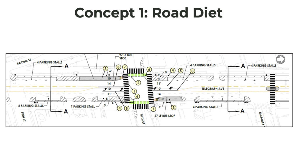
Roadway top-down illustration showing curbside projected bike lanes to the right of parked cars, but no bus-only lane.
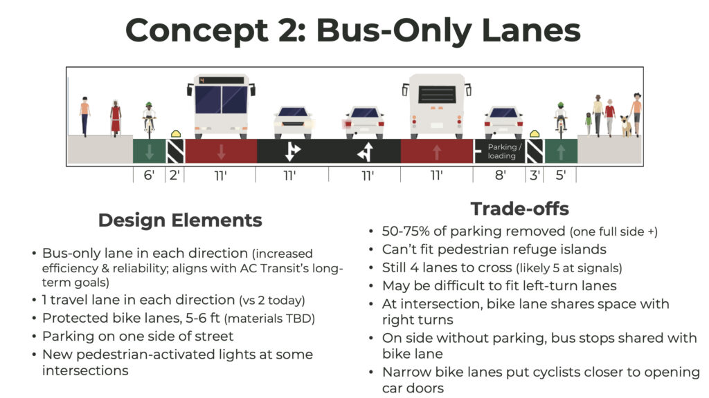
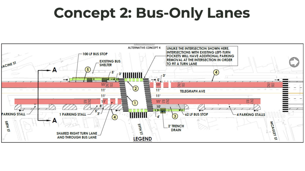
Roadway cross section illustration showing curbside projected bike lanes and bus-only lanes, with car parking only on one side of the street. Text: "Concept 2: Bus-Only Lanes Design Elements • Bus-only lane in each direction (increased efficiency & reliability; aligns with AC Transit's long-term goals) • 1 travel lane in each direction (vs 2 today) • Protected bike lanes, 5-6 ft (materials TBD) • Parking on one side of street • New pedestrian-activated lights at some intersections Trade-offs • 50-75% of parking removed (one full side +) • Can't fit pedestrian refuge islands • Still 4 lanes to cross (likely 5 at signals) • May be difficult to fit left-turn lanes • At intersection, bike lane shares space with right turns • On side without parking, bus stops shared with bike lane • Narrow bike lanes put cyclists closer to opening car doors"
Roadway top down illustration showing curbside projected bike lanes and bus-only lanes, with car parking only on one side of the street.

PROJECT INFO HERE

Details
Date:
January 17
Time:
5:00 pm - 7:00 pm UTC
Cost:
Event Category:
Website:
Location
Organizer