The Caltrans D4 Bike Plan Needs Your Input
For many years, Caltrans freeways have been major barriers to safe walking and bicycling, often only passable by dangerous overpasses and high-speed interchanges. Caltrans also controls many major arterial streets, including San Pablo Avenue, East 14th Street, and Mission Boulevard, and they too lack bikeways and safe crossings.
Now, Caltrans is making an effort to better serve people on bikes by creating a bike plan specific to District 4, which encompasses the entire Bay Area. The vision is a “comprehensive planning document to improve safety and mobility for bicyclists on and across the state transportation network in the Bay Area region.” Caltrans has set the ambitious goal of tripling bicycling in California by 2020, and making good on that goal means taking bike infrastructure seriously throughout the highway system.
As part of the planning process, Caltrans is asking the people to give input using an online survey, interviewing focus groups, and holding public workshops. The focus groups are designed to engage low-income communities of color that have historically been left out of planning processes with great impact to their neighborhoods and environment. In the East Bay, Caltrans is taking time to hold focus groups with Rich City Rides in Richmond and Cycles of Change in East Oakland to make up for this historic injustice–and compensating participants for their time. This is a good first step, and we need you to help us continue holding Caltrans accountable for a better future.
Public Workshops Coming During Bike Month
In addition to the online survey, Caltrans will host two rounds of public workshops to get feedback on the plan. The first round does not have any locations in the East Bay, but we hope you can attend a workshop in neighboring counties by using transit and your bike:
Envisioning a Better Caltrans
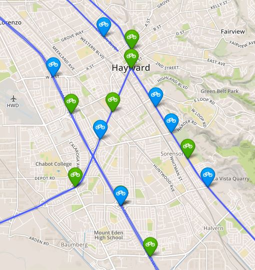
The bike plan survey will ask you to mark the state highway map with five types of pins: where you currently cross or travel along the network, where you want to bike across or along the network, barriers to bicycling, good places to bike, and places you would like a new and improved bikeway. We spent some time filling out the map and suggest you do too. Here are some examples we came up with for each category:
Where We Bike
Whether we like it or not, we often find ourselves bicycling along State Route 123–also known as San Pablo Avenue. Running from Richmond to Emeryville, San Pablo is a key commercial and transportation corridor. Even though many people already bike along San Pablo, it can be a high-stress ride and is an ideal candidate for some protected bike lanes.
Where we Want to Bike
Bicycle access across the Bay Bridge was one of the founding issues of the East Bay Bicycle Coalition, now Bike East Bay. After years of advocacy, there is finally a bike path on the east span of the Bay Bridge. Thanks to your advocacy, the path will be open seven days a week by Bike to Work Day. Now, you can help determine designs and advocate for the future west span bike path.
Barriers to Biking
Freeways throughout the Bay Area are major barriers to bicycling and walking, especially in low-income communities of color. In many neighborhoods, the only way to cross a freeway is on a overpass with high-speed on- and off-ramps.
 In October, Jose Enciso Hernandez was struck and killed while riding his bicycle over the dangerous Tennyson Road overpass at I-880 in Hayward. Jose was the second person killed while walking or biking on this overpass in 18 months. Following this tragic news, Bike East Bay staff immediately asked Caltrans and the City of Hayward to improve bicyclist and pedestrian safety along corridor. However, changes to the overpass itself are moving slowly. While Caltrans has agreed to upgrade crosswalk visibility, this project may be delayed until 2018.
You can help tell Caltrans to prioritize dangerous overcrossings to improve bike safety and access.
Good Places to Bike
There are some great bikeways on Caltrans property. One of our favorite examples is the bike path on the Carquinez Bridge, between Crockett and Vallejo. Connecting the East Bay to Solano County, the newer span of the Carquinez Bridge has a nice wide path for bikes, along with gorgeous views of the North Bay.
Needs a New and Improved Bikeway
Anyone who has biked the narrow path through the Posey Tube between Alameda and Oakland can tell you: it’s not fun. Bike Walk Alameda and Bike East Bay have been asking Caltrans to study possibilities for a bike and pedestrian bridge to connect Oakland to the west side of Alameda, improving access and relieving traffic through the tubes under the Estuary. We dropped a pin on the tubes to ask for a new bike bridge in the future.
Learn more about the Caltrans District 4 bike plan.


