The City of Albany is currently updating its Active Transportation Plan, which was developed in 2012 and last updated in 2019.
The new Active Transportation Plan is an opportunity to reaffirm community priorities, analyze new data, and incorporate the latest technology and best practices.
The update process is expected to continue through Fall 2025, with several opportunities for community input and involvement. Sign up for the project mailing list at the bottom of the page to receive updates and notifications.
Provide input via an online map and survey here
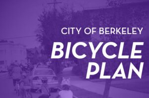
This effort is an update to Berkeley’s 2017 bicycle plan, to identify opportunities for changes and improvements to the previous recommendations around bike infrastructure, policies, and programs.
Your input will help the project team develop a new bicycle policy framework that will ultimately guide the city’s priorities and decision making, all while making it easier, safer, and more comfortable to bike and roll in Berkeley.
Once the Plan Update is complete, it will include a list of project recommendations that will help Berkeley:
- Address locations that currently make it challenging to bicycle or roll
- Build upon its “low-stress” network of bicycling and rolling routes
- Make bicycling and rolling safer and more comfortable for people of all races, ethnicities, incomes, ages, and abilities
Freeway interchanges and state-owned surface streets (like parts of San Pablo Ave, Mission Blvd, International Blvd, Ashby Ave, and others) are among the most dangerous places for biking in the East Bay.
Help Caltrans prioritize improvements via their bike plan update by adding comments to this map, and favoriting other people’s comments.
Draft plan, map, & comments page here
The Newark Active Transportation Plan is an opportunity to advance infrastructure that supports walking, biking, and rolling throughout the City.
The Newark Active Transportation Plan is an update to the 2017 Pedestrian and Bicycle Master Plan, a comprehensive planning document that develops and prioritizes infrastructure improvements to support walking, biking, and rolling (e.g. mobility devices, skateboards, and scooters) in the City.
The Active Transportation Plan will recommend improvements that expand a safe, comfortable, and connected active transportation network for all ages and abilities.
The Pinole Active Transportation Plan (ATP) aims to create a comprehensive vision for enhancing pedestrian and cycling experiences in Pinole, catering to individuals of diverse ages and abilities with the goal of decreasing Vehicle Miles Traveled (VMTs).
Click through to learn more, add your comments via the web map and survey, and find dates for in-person pop-up events around Pinole.
Provide input via an online map here
![]()
The City of Pleasanton is updating its Bicycle and Pedestrian Plan in 2025-2026 to help shape the future of walking, biking, and rolling in Pleasanton. This update builds on the plan adopted in 2018 and will include completed projects, current community needs, and new ideas in street design.
Click through to learn more, add your comments via the web map and survey, complete a survey, and sign up for the notification list.
![]()
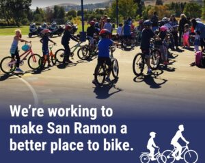
The San Ramon Public Works Department has started the process of updating the San Ramon Bicycle Master Plan (BMP), which was last updated in 2018.
The BMP serves as a guide for the development of safe and accessible bikeways and paths within San Ramon.
The purpose of the Bicycle Master Plan Update is to review the 2018 plan, identify what has been implemented since then, and develop refreshed strategies to improve safety and access and to encourage bicycling throughout the city.
This update will outline updated goals, policies, physical improvements, educational programs, and funding/implementation strategies.
Provide input via an online map here