The Park District invites you to participate in the second round of public engagement. A series of online activities are designed to capture your opinions on how the Park District should approach future decisions. Activities ask for your input on:
Draft goals for the District Plan
Priorities related to the functions and activities of the Park District
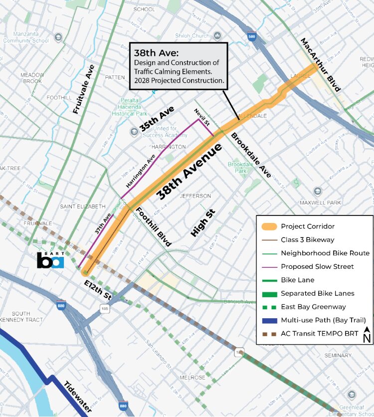
In 2028, OakDOT will repave 38th Avenue from E 12th St to MacArthur Blvd. Along with repaving, the goal is to create a slow and calm street for all users, especially people walking and biking. Visit the 38th Avenue Traffic Calming Project webpage for more details, such as proposed plans. Please share your experiences with 38th Avenue to help build the best project possible.
Click here to complete the survey available in Spanish, Chinese, and English.
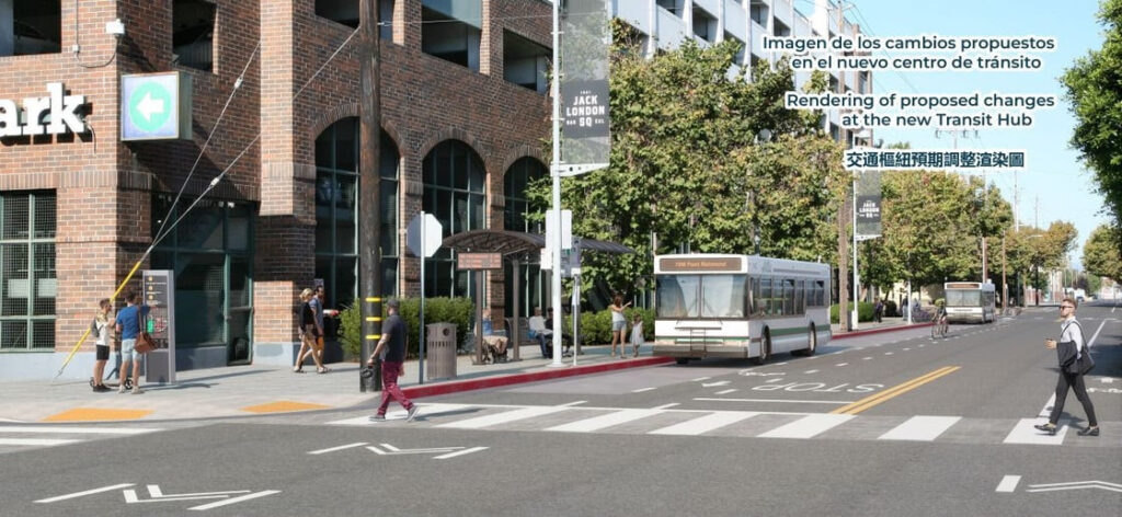
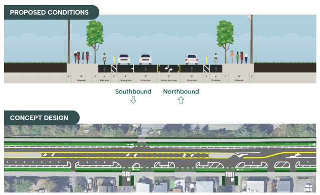
This project is proposing bus stop upgrades and new routes around Jack London Square, including some changes to bikeways.
Complete this survey by March 31, 2026, and write in that you want the project to include a protected bikeway on 3rd Street as recommended in Oakland’s bike plan, not only a painted bike lane on 2nd Street.
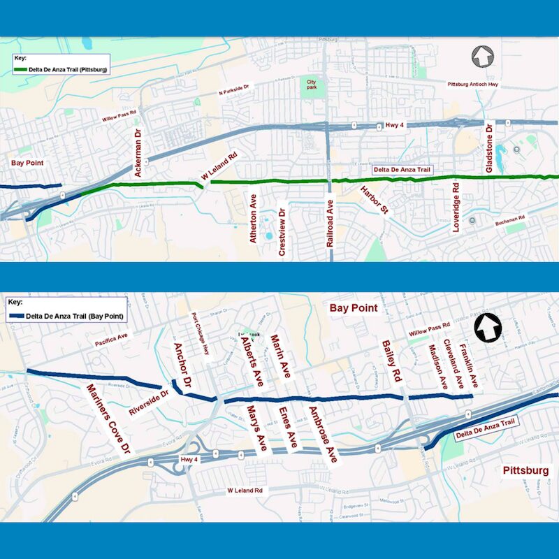
Your input is needed to inform design and facilities improvements for the Delta De Anza Trail through Bay Point and Pittsburg, both along the trail and at crossings.
Please take 5 minutes to complete the survey and include comments asking for more trail lighting, shade structures and landscaping, and more direct crossings of busy roadways along the trail.
Click here to complete the survey by April 24, 2026.
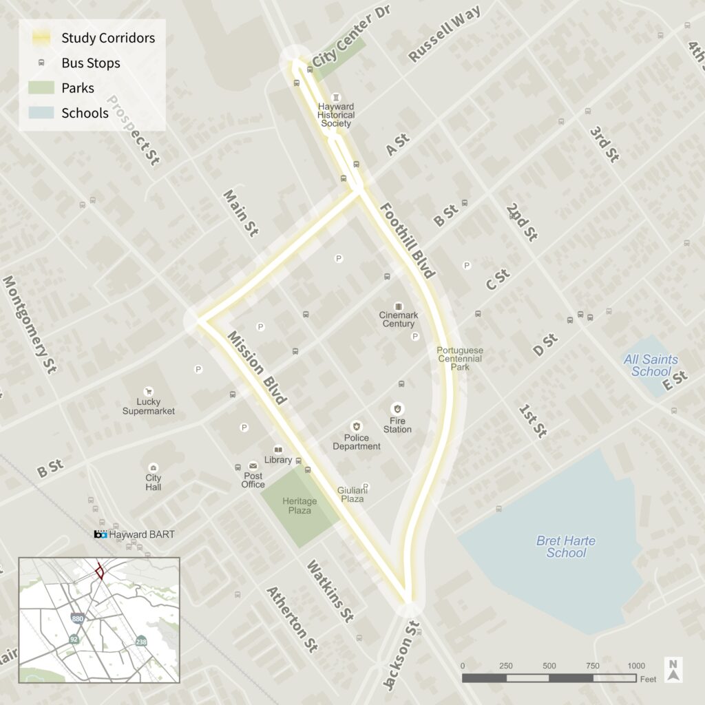
Safe Streets Downtown is a City of Hayward initiative to transform the Hayward Loop to create a safer, more accessible and community-focused Downtown.
This study is currently underway to look at potential redesigns on Mission Blvd, Foothill Blvd, and A Street, helping to prioritize safety and access for people biking and walking.
The study website is available here. Check it out and complete the survey, writing in that you want to see continuous, protected bikeway on Mission Blvd.
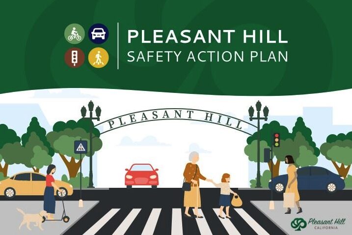
Pleasant Hill Safety Action Plan
The City of Pleasant Hill is taking a major step towards enhanced roadway safety through the development of the Pleasant Hill Safety Action Plan. The goal of the study is to analyze collision data and incorporate community input to inform projects and strategies that reduce safety risks and eliminate traffic-related fatalities and severe injuries. Your input is vital to achieving a safer transportation network for all road users.
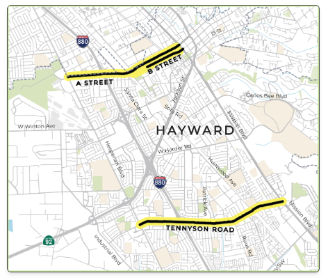
The City of Hayward is developing roadway safety plans for streets across the city. This project is evaluating three priority streets:
A Street from Hesperian Blvd to Watkins St
B Street from MLK Dr to Watkins St
Tennyson Road from Hesperian Blvd to Mission Blvd
These streets are part of the City’s “High-Injury Network” – just 14% of city streets where over 75% of serious and deadly crashes happen. These three streets alone accounted for 11% of all collisions and 13% of all people killed or severely injured in traffic crashes from 2019-2024.