The Park District invites you to participate in the second round of public engagement. A series of online activities are designed to capture your opinions on how the Park District should approach future decisions. Activities ask for your input on:
Draft goals for the District Plan
Priorities related to the functions and activities of the Park District
Contra Costa Transportation Authority is Listening
Contra Costa Transportation Authority (CCTA) plans, funds, and delivers transportation projects that connect communities across the county. They want to hear from you about your transportation experience, including what’s working and what needs improvement! Your perspective helps shape the future of transportation in Contra Costa County.
This General Plan Update is a way for you to share your vision for the future of Antioch. We need your help to make the General Plan a success.
Looking forward 20 years, how will state and regional trends impact life in Antioch? What new technologies and innovations will change how we live, work, and play? While we can’t see exactly what the future holds, we are preparing for it by updating our General Plan.
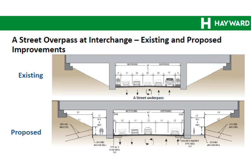
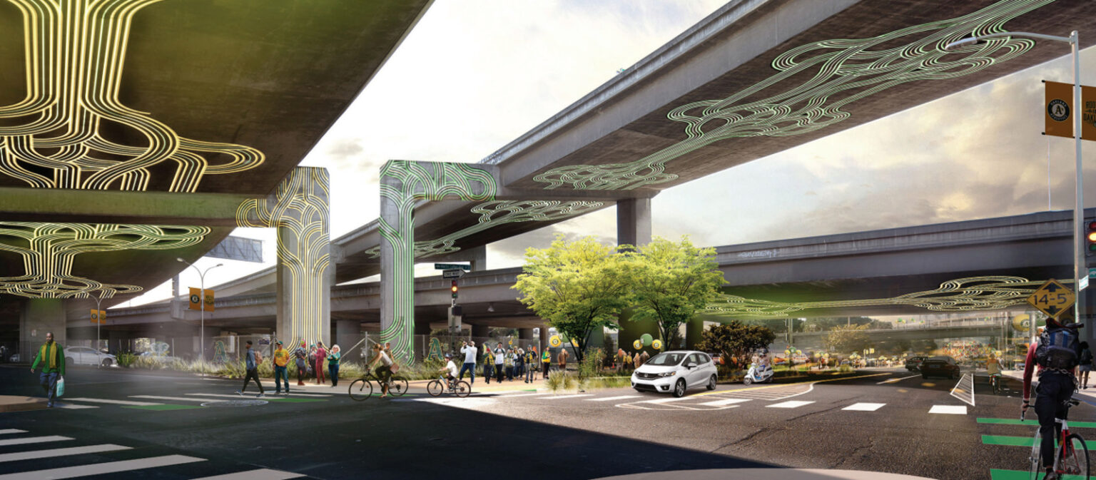
The Reconnecting Hayward Communities through A Street Safety Improvements Project will include safety and active transportation improvements along the A Street Area at the Interstate 880 interchange in the City of Hayward. The proposed project will reconfigure the A Street interchange by removing existing free‑flow ramp movements and converting ramp terminals to signalized intersections. The project will construct Class IV separated bikeways, shared‑use bicycle and pedestrian facilities, and ADA‑compliant sidewalks.
Iron Horse and Contra Costa Canal Trails Connection Feasibility Study
Connected trails make it easier to walk, bike, reach transit, access open space, and get around safely. Now, CCTA wants your feedback on how to better connect two of Contra Costa’s most important regional trails: the Iron Horse Trail and the Contra Costa Canal Trail.
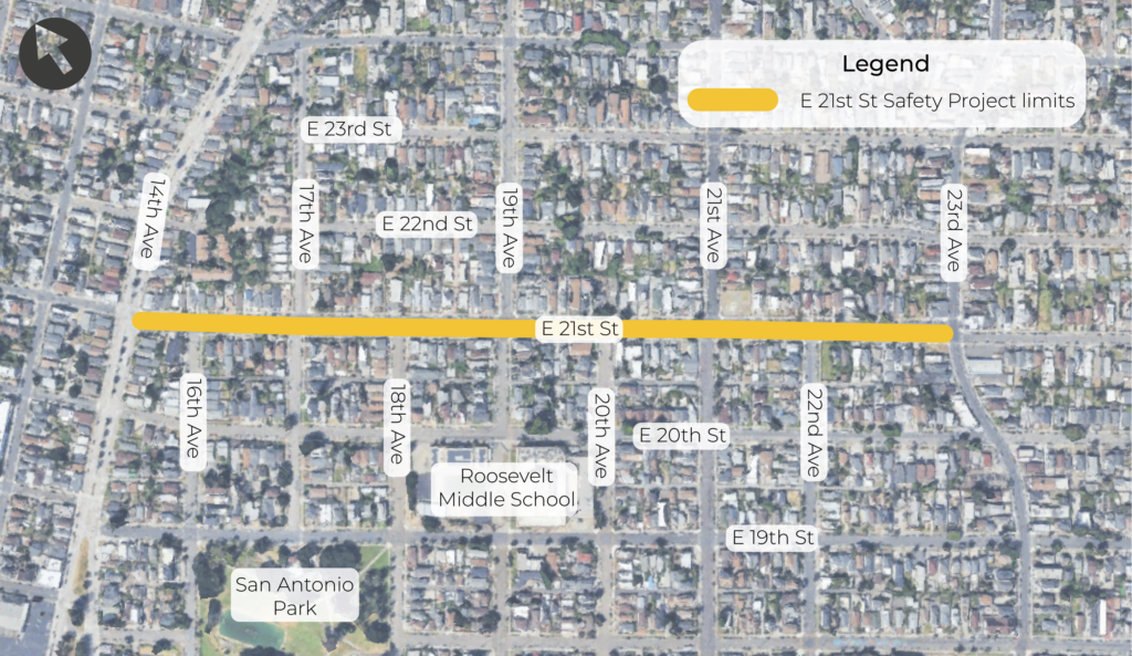
The E 21st Street Safety Project will make improvements to prevent vehicle speeding and other dangerous driving behaviors on E 21st Street between 14th Avenue and 23rd Avenue. The project will also evaluate improvements to improve safety and accessibility for people walking, biking, and riding the bus.
Click here to learn take the survey, available in Spanish, Vietnamese, Chinese and English.
In 2028, OakDOT will repave 38th Avenue from E 12th St to MacArthur Blvd. Along with repaving, the goal is to create a slow and calm street for all users, especially people walking and biking. Visit the 38th Avenue Traffic Calming Project webpage for more details, such as proposed plans. Please share your experiences with 38th Avenue to help build the best project possible.
Click here to complete the survey available in Spanish, Chinese, and English.
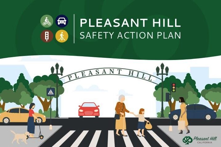
The City of Pleasant Hill is taking a major step towards enhanced roadway safety through the development of the Pleasant Hill Safety Action Plan. The goal of the study is to analyze collision data and incorporate community input to inform projects and strategies that reduce safety risks and eliminate traffic-related fatalities and severe injuries. Your input is vital to achieving a safer transportation network for all road users.
Genoa Street is the heart of the Santa Fe neighborhood. It’s a vital corridor in North Oakland used daily by families, cyclists, dog walkers, and pedestrians. But it’s dangerous. Drivers speed through to reach the freeway, and the two-way stops along Genoa create confusion that puts cyclists and pedestrians at real risk. Serious accidents and close calls are a constant reality, especially during rush hour. There is an opportunity to change that, as part of Oakland’s five-year pavement project.
Click here to share your experience, and stay in the loop of this project.